Trail
Pambak Ridge Traverse
7–8 hrsHardJuly–September21 km
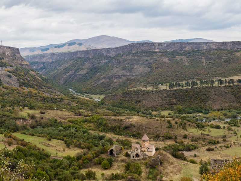
The Pambak ridge forms the southern boundary of Lori Province, a mountain spine separating the Debed watershed to the north from the Pambak valley to the south. This traverse follows the ridgeline for 12 kilometres at altitude, between 2,200 and 2,450 metres, with views in clear conditions that extend in all directions: Aragats (4,090 m) to the south, the Georgian border ranges to the north, Vanadzor town directly below to the east. On a clear day, you can see Mount Ararat if you're standing high enough — which you will be.
The route starts from Mets Sepasar village, 15 km south of Vanadzor by road. You'll need a taxi to get there. From the village, a shepherd track climbs uphill for three hours to reach the ridge at around 2,200 metres. The ascent is steep but not technical. The ridge itself is straightforward — open grass and scree, no technical climbing — but the exposure and the altitude gain require a full day and proper preparation. Descent into Vanadzor via the Pambak valley floor takes 2–3 hours. Total distance: approximately 21 kilometres. Total elevation gain: approximately 1,100 metres.
The summit area is at 2,450 metres — above the treeline, fully exposed to weather. Conditions can change in under an hour. A sunny morning can become a windy, cold afternoon fast. The sun at that altitude burns skin quickly. The wind is constant above 2,000 metres and can be fierce on the ridge itself. This is not a walk. This is a mountain traverse. Start early — aim for 6 or 7 am — so you have daylight for the descent. Carry more water than you think you'll need. The only water sources are springs at around 1,800 metres during the ascent. There is no water on the ridge.
Navigation: There is no marked trail on the ridge. You need either GPS or a local guide. Many people hire a guide from Vanadzor — worth the expense for the route finding and the company. Do not do this alone. The ridge itself is simple enough, but if clouds roll in and visibility drops to 50 metres, you need someone who knows where the trail is. Weather is the biggest risk. Check the forecast. If there's thunderstorm potential, reschedule. If you're caught on the ridge in a storm, you're in danger.