Hovhannes Tumanyan lived 54 years, from 1869 to 1923, and in those 54 years he became the most beloved writer in Armenian literature. Most Armenians have encountered "Anush"—his poem that became an opera, a kind of national possession, a story that lives now in music and voice as much as it ever lived on a page. Many know "The Fool," a children's story that explains something about kindness that formal instruction never could. Fewer know that during the First World War, when the Ottoman Empire was committing genocide against the Armenian population, Tumanyan worked tirelessly to provide aid to refugees, traveling between camps, documenting suffering, and using his status as Armenia's most famous writer to draw international attention to what was happening. He died in the work. The man mattered. He still matters.
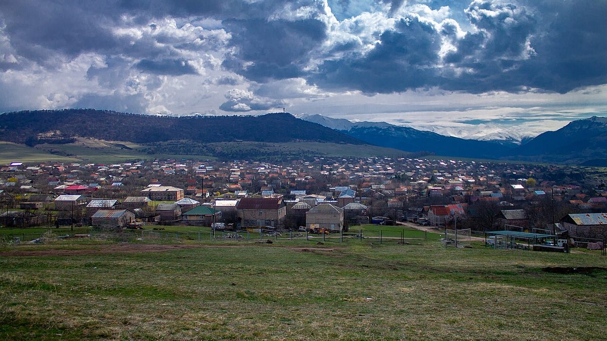
And he came from Dsegh. A small village at 600 meters elevation, in the Lori region, where his family lived and where his childhood was spent. The village is unremarkable if you don't know this. But it is the birthplace of the Armenian literary giant, the writer who, in the final accounting, belongs not to Lori but to all of Armenia. The house where he lived is still there, now a museum. The spring where he would have drawn water is still there. And from this village, the land unfolds north.
The walk from Dsegh to Haghpat Monastery is about 15 kilometers, not a great distance but a real journey. It descends from the village elevation down into the Debed canyon, follows the river through a landscape that has barely changed since Tumanyan walked it, climbs back up through forest to the monastery platform. It's a walk that most visitors never take. They arrive by car at Haghpat, spend 45 minutes photographing the medieval stone walls, and drive away again. They miss what the walk shows you, which is continuity: the fact that this landscape connects these places, that there is a path, that people have moved through it for centuries, and that the poet whose words are in your language walked it too.
Beginning at the House
The Hovhannes Tumanyan House-Museum sits on the eastern side of Dsegh, a modest building with a modest sign. Inside, the space is simple: rooms where he lived, documents, photographs, small objects. But there's a weight to it. Not a touristic weight—there's no atmosphere of heritage management or curated display. It's the weight of actual lives that happened here. The guide (if you've arranged ahead) will show you the room where he studied, the courtyard where he played as a child. Will mention his mother, his siblings, the particulars that tend not to make it into the biographies. And then they'll point north and say: this is where the walking country is.
The spring is a few minutes from the house, flowing year-round, cold and clear. This is a good place to fill your water bottles and take a moment before beginning the descent. The village itself clusters around you—stone houses, some occupied, some in slow decline, a church that is still in use, the particular quietness of a place that has been partially emptied of its young.
Into the Canyon
The path that leads down from Dsegh is not marked on any map that tourists carry. It's a local path, used by locals, known to locals, and it drops into the Debed canyon through mixed forest—birch, oak, pine—following the general contour of the land. The descent is perhaps 200 meters over about two kilometers, gradual enough that it doesn't strain the knees but real enough that you know you're moving. As you descend, the canyon walls begin to show themselves. First on one side, then both sides, the land rising up in stratified stone—basalt, tuff, older formations. The river becomes audible below, its water sound filtering up through the forest.
Where the trail reaches the canyon floor, it joins a broader path along the Debed itself. Here the canyon narrows significantly. The walls rise sheer on both sides, 200 meters or more. The river passes through a gorge, the water moving with purpose, particularly powerful in spring when the snowmelt is coming down from higher elevations. And there, where the gorge narrows most, is a bridge—a simple stone bridge, relatively modern (maybe 100 years old), built to span the river at the one point where the passage is narrow enough to bridge.
This is a crossing place. It's not hard to imagine the significance it would have held. Caravans crossed here. Traders moving between Georgia and the Armenian plateau. Local people moving between villages on either side of the canyon. And somewhere in the centuries—the exact date is uncertain, though local knowledge suggests maybe the 17th century—someone built a caravanserai here. The remains are visible from the trail: foundation stones, parts of a wall, a structure that has mostly returned to the landscape but whose purpose is still readable if you know what you're looking at. Horses stopped here. People ate and slept and continued. The structure is gone but the pause it represented is still present in the place.
The path follows the river for several kilometers. It's sheltered by the canyon walls, so even in hot weather it's cool. In spring, the undergrowth is thick and green. You're walking beside a river that matters—the Debed is large enough to have shaped the entire landscape, to have carved the canyon you're in, to have made Lori what it is. It's the river of this place.
The Climb and the Arrival
The path begins to climb perhaps eight kilometers north of the bridge. The forest thickens. You're moving back up in elevation, climbing toward the plateau where Haghpat sits. The ascent takes about two hours from the canyon floor, and it's real climbing—enough that you'll feel it in your legs. But the forest insulates you. It's quiet. The sense of journey intensifies. You've crossed the deepest part of the geography. Now you're rising again, moving back toward civilization, toward the monastery you started this walk to reach.
And then, as you rise through the final section of forest, you see it: the bell tower of Haghpat Monastery above the trees. It appears suddenly—one moment you're in the forest, the next there's stone and geometry and the evidence of a thousand years of continuous religious practice visible above the green. The forest opens. The ground becomes less steep. And you emerge onto the platform where the monastery complex sits, facing south toward the canyon you've just climbed out of.
"Most visitors arrive by car and spend 45 minutes photographing stone walls. They miss what the walk shows you: continuity, connection, the fact that people have moved through this landscape for centuries."
The monastery is not crowded. There will be monks, going about their work. There will be other visitors, but fewer than at popular sites. The courtyard has the particular quiet of a place that is actually in use, has been in continuous use, has been someone's home and workplace for more than a millennium. The churches—there are multiple, built at different periods—contain the accumulated weight of that time. The khachkars (carved stone crosses) in the courtyard are beautiful and also very old. Some are monuments. Some are grave markers. They're in the actual cemetery of the monastery. The people these were made for are long dead, but the stones remain, and so does the monastery around them, and so do the monks continuing the work.
Why Most People Don't Make This Walk
The walk takes a full day if you start at Dsegh and end at Haghpat—roughly six to seven hours of actual walking, plus breaks, plus time spent at the museum and the spring. It's the kind of day that's not difficult technically but does require commitment. And it means arriving at Haghpat tired, thirsty, and needing to find accommodation nearby. This doesn't fit the tourism model that dominates visits to Lori. The model is: get to the monastery early, photograph it, eat lunch, return. This is the model. It's reasonable, it's practical, it's how most of tourism works.
But it means that most people never understand the continuity that the walk makes visible. They never see how Dsegh connects to Haghpat, how the landscape connects them, how you could actually live in one place and travel to another using your body and the paths people have used for centuries. They never arrive at the monastery tired from walking, in the physical state Tumanyan would have been in when he traveled this way (though probably on horseback, and probably the other direction, from Haghpat toward his home). They never feel the shift from canyon floor to plateau in their legs and lungs.
If you have time, if you're willing to be tired, if you understand that understanding requires effort, then the walk from Dsegh to Haghpat will show you something that the standard visit cannot. It will show you what the landscape actually is, and how the people who have lived here have inhabited it, and why the poet who came from Dsegh mattered. And when you reach the monastery, you'll understand that you've completed not a hike but an arrival, and the place will mean something different than it would have if you'd driven.
Ready to walk in Tumanyan's footsteps? Plan your journey through these historic villages and monasteries. Learn more about Haghpat Monastery and Dsegh village.